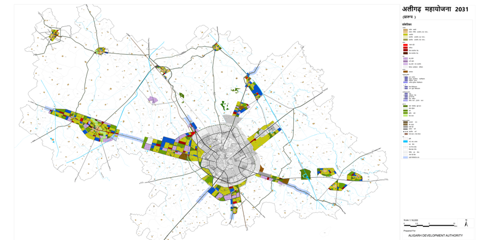
Preparation of a Comprehensive GIS-Based Master Plan for Aligarh
Covering an Area of Interest of 748 Km², this project encompasses land use planning, infrastructure assessment, mobility studies, and long-term development frameworks aligned with projected growth up to 2031.
Key Highlights
Area of Interest: 748 Km² designated for Aligarh Master Plan 2031
GIS-based base map preparation and satellite imagery georeferencing
Comprehensive land use survey and building use survey
Traffic and mobility study across the planning area
Demographic and socio-economic data analysis
Demand-supply gap assessment and development strategies
Draft Master Plan with zonal plans and development control regulations
Outputs Delivered
Inception Report with existing situation assessment
GIS-Based Basemap and existing assessment report
Data Analysis Report (sector-wise)
Identified Strategies and assessment report
Draft Proposal Report and Draft Master Plan
Location:
Aligarh, Uttar Pradesh
Category:
GIS, Urban Planning, Master Plan
Client:
Aligarh Development Authority & Town & Country Planning Department, Uttar Pradesh